Tuesday, 15 July 2014

Walk 178

South Erradale to Melvaig 21miles

Today was an all road day which was a nice change from yesterdays exertions. The first few miles were along a quiet track which took me firstly past Opinan then onto Port Henderson, Badachro and finally yet another Sheidaig.

Opinan

 Just after Sheildaig the rain came, I sheltered under a tree waiting patiently for the worst to pass but 15mins later I gave up and forged on regardless.  The quiet road soon met up with the much busier A832 and it was "hope I don't get squished by a lorry" time, the road passed through Charlestown and finally into Gairloch

Gairloch Beach
As you can see Gairloch has a fabulous beach, the facilities are a bit meagre but I finally found a pub that did lunch and so I was happy.  The busy road tailed off north and I took the much more sedate B road towards my final destination of Melvaig.  The sun had made a reappearance once I reached Big Sand which is another great descriptive name and really says it all about the place.
Big Sand
The final few miles took me through North Erradale and Perterburn finally arriving in Melvaig where just as I was settling into my room for the night a Submarine went past the BnB in the bay, this is my first sighting of a submarine at see ever!
Caoles Beag

Accommodation: Fionncroft, Melvaig. A small bnb run by a very nice lady who left a note on the front door telling me which room I was stopping in tonight.  £40.00 BnB

Saturday, 5 July 2014

Walk 177

Sheildaig to South Erradale 28.5miles

The first stop today was the actual village of Sheildaig, I was hoping to stock up on supplies but unfortunately nothing was open!
Shieldaig
I made my way out of the village and linked up with the A896 which is a main road of sorts! the road took me along the south bank of Upper Loch Torridon and everywhere I looked I was surrounded by spectacular mountain ranges.

Torridon Mountains
I soon turned off the main road passing by the Youth Hostel at Torridon and finally finding a shop to stock up with goodies including my first ice cream of the holiday! Not long after Torridon I took a track marked on the map which looked interesting, this led me around the loch to Inveralligin, just as I was walking out of this hamlet I heard a strange moaning noise coming from a house and couldn't quite pick what the sound was, but then suddenly it all became clear........bagpipes! the haunting tune was fantastic and it followed me all the way around the bay.

The road out of Inveralligin took me up and down some very steep hills towards Lower Diabaig passing by Loch Diabaig on the way, this was thankfully the last of the road walking for the next 8miles.
Loch Diabaig
At Lower Diabaig I took the track to the Bothy at Craig this a well worn track that is very easy to follow and relief from all the previous days road walking.  Just before Craig there is a steep and rocky descent down into the valley where there is a nice footbridge to take me onto the next part of the walk to South Erradale, the path after Craig is a lot less distinct and after a couple of false trails I managed to find a decent sheep track that took me all the way to Redpoint.
Redpoint Beach
 Accommodation: Croft 23, South Erradale. £50.00.  A new build BnB run by a lovely couple from Yorkshire.


Walk 176

Applecross to Sheildaig 23miles

Today was another hot one so I started early on my walk around the Applecross peninsula.  All of the walk was along roads which at 9am on Sunday morning were thankfully quiet.  I headed out of Applecross and the road swung north with my first stop at Sand which is a cool name for a beach says it all really!
Sand
The road continued on through Londain, Callakille and Cuiag, I had now picked up Raasay and Rona Islands on my left finally leaving behind Skye.

Raasay and Rona
The final settlement on the western side of the peninsula is Fearnmore the road then started to head south towards Arrisa along Loch Torridon.
Arrisa
The road wound its way through forest and past lochs, up and down before arriving in Inverbain where just a few yards in front of me a Pinemartin ran across the road, he was too quick for me to get the camera out but a first for me!  I was now walking along Loch Sheidaig passing by the many islands in the bay, before arriving at my bed and breakfast for the night hot and very very thirsty!
Loch Sheildaig
Accomodation: Kinloch BnB, Nr Sheildaig £40.00. This was very nice with fabulous views and very quiet.

Sunday, 29 June 2014

Walk 175

Kishorn to Applecross 14miles

Its only been 3 weeks since my last walk and today's hike up the Bealach Na Ba is one I've been looking forward too for a very long time.  I started the day bright and early in Inverness with a train journey to Strathcarron where I hoped there would be a bus waiting to pick me up to take me on my final leg to Kishorn, the bus was there! hooray for public transport!!!  Bryn the bus driver had to stop in Locharron to pick up someones sausages from the butchers, bus driver and delivery boy all rolled into one.  Soon enough I was standing on the roadside in Kishorn looking up at today's "monster" climb over the Bealach, I wound my way around the small A896 towards Tornapress where I turned right and was immediately faced with a nice warning sign telling me I could go around the hill if I wanted too but as it was 23deg warm and sunny I decided to ignore it!  The first part of the climb was relatively easy and gently climbed to 600ft this soon ended as I turned the first sharp corner and things started to get steep, I was passed by a few cyclists who informed me as they struggled up the hill that I would probably catch them up in a while, needless to say I didn't!


1000 Ft View

I had to stop and admire the views a lot and I felt sorry for the car drivers who passed me and wasn't able to stop on this road and look at what I could see. Not long after 1500ft the tough part of the climb came with the hairpin bends all the way to the summit.

All to soon I was at the top and according to my GPS the summit was in fact 2083ft but who knows, I certainly wasn't going to get my measuring tape out!!!!

The journey down into Applecross wasn't as nice as the climb but you do get some great views across the bays to Skye and beyond.  I had to admire the skill and nerve of the cyclists as they tackled the downhill stretch, they were going at some speed.

Accommodation: Applecross Youth Hostel.  This hostel is located just outside Applecross at Hartfield, the accommodation has just been built and it was a great nights stay at £25.00 for my own room, there is a restaurant just around the corner that does fantastic veggie breakfasts


Tuesday, 3 June 2014

Walk 174

Locharron to Kishorn 11miles

I really enjoy these short walks at the end of my week away and this was no exception! A small quiet road took me out of Locharron towards Strome Castle, there is not much left of this castle now but its in a lovely setting.
Strome Castle
The road then took me down to Ardaneaskan which is right at the end of a peninsula but still has 2 bed and breakfasts! I  picked up a track taking me through a forest to Loch Reraig, this track then heads back on yourself and I started to wonder if I was going the right way but soon there was a sign and all was right with the world! The track was great and several cairns kept me on the right route, I headed onwards and upwards eventually topping out at a measly 624ft.
The views to Ardarroch are stunning and I could just see in the distance the road that goes over the mountain to Applecross but that's for another day......

Walk 173

Nostie to Locharron 29miles

Today was all road walking and I started off along the busy A87 fortunatley this only lasted for 6 miles but the views of Skye were great and the Skye bridge was very impressive.
Skye Bridge
I stopped in Kyle of Lochalsh to pick up some supplies and take a pic of where the railway ends, I wouldn't want to overshoot this station!
The End of the Line!!
I headed north from Kyle on a very quiet road passing through Creag-Dhubh, Drumbuie and Diurinis before arriving in Plockton complete with palm trees! I took a track that runs parallel with the railway but is not marked on the map, this in turn led me to Duncraig Castle but sadly its covered in scaffolding as its undergoing a major restoration.  I was now on the south bank of Loch Carron and the road wound its way through forest passing by Stromeferry(no Ferry) where there is a fantastic viewing platform in order to take photos of the Loch and surrounding scenery.
Loch Carron
Looking at this photo now and its hard to believe that less than an hour later the low cloud and rain came and you couldn't see more than a hundred yards in front of you!

So once the rain arrived I trudged onwards to Strathcarron where I stopped at the Hotel for a Cuppa in the hope the rain would hold off for a while, and for once I was lucky! I walked along the causeway at the bottom of the Loch and a sharp left took me along the road to my hotel for the night.

Accommodation: Locharron Hotel. Nice, but the single room they gave me is right next to the entrance, so it was very noisy and I didn't sleep too well. £39.50 BnB

Wednesday, 28 May 2014

Walk 172

Glenelg to Nostie 24miles

Bernera Barracks
It was a bit of a grey miserable day as I started out today, I walked out of Glenelg via the Bernera Barracks  I took a photo but unfortunately due to the conditions it all looks a bit dull!

I'd done some research on the Web about today's walk the night before and found that where I was walking today is part of the Lochalsh Dirty 30 which is a cross country running race, this was useful to know as it may mean a decent path today if its well trodden.....or so I thought!!!

The first part of the walk was along a road which leads to the ferry crossing taking you to Skye. This is the last manually operated turntable ferry in Scotland, fortunately for me the ferry was being loaded as I walked past and I stood for a while watching the ferryman in action, its quite a snazzy bit of kit!!

Skye Ferry
I continued my walk along a good track walking under the electric pylons which had been so helpful on yesterdays walk, this lead me eventually to Ardintoul Point, I stopped here to ask directions as it was unclear on my map which way I was supposed to be going, the man I asked pointed me in the direction of a hill and off on toddled, I got halfway up and thought that this is wrong but I continued on anyway but low and behold he was correct! a sign at the top of the hill pointed me towards Totaig.  The track was quite good until I reached the forest and then it just stopped!! I had noticed though a white piece of tape hanging from a tree, I started to follow these markers because I assumed that they had been put there for the cross country runners. The markers took me deeper into the dense dark forest and I can now see why its called the " Lochalsh dirty 30" because it was just horrendous, talk about mud, I could bearly walk let alone run!!!
The Markers
The white tape markers soon turned to wooden sticks with an orange flash painted on them, this was very useful and I stumbled on through the forest eventually coming out at a clearing at the top of Castiel-Grugaig, and what a view from the top looking down on Dornie and the castle at Eilean Donan!!
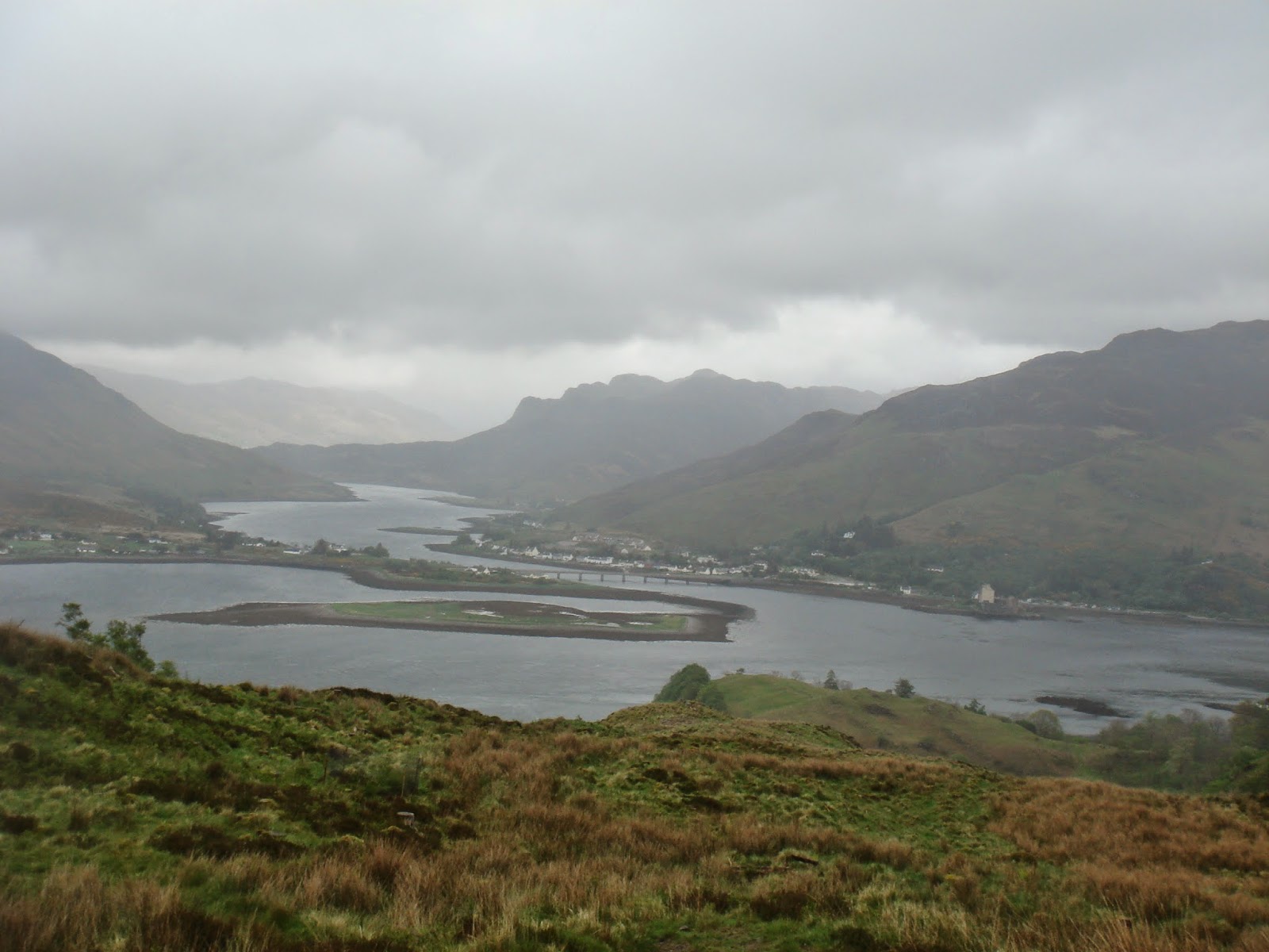

The View to Dornie

I made my way down the hill arriving in Totaig and started the long long long walk to Nostie along the banks of Loch Druich, there were thankfully small minor roads to Sheil Bridge but then I picked up the busy A87 taking me to Dornie, where I stopped for the obligatory photo of the castle at Eilean Donan.
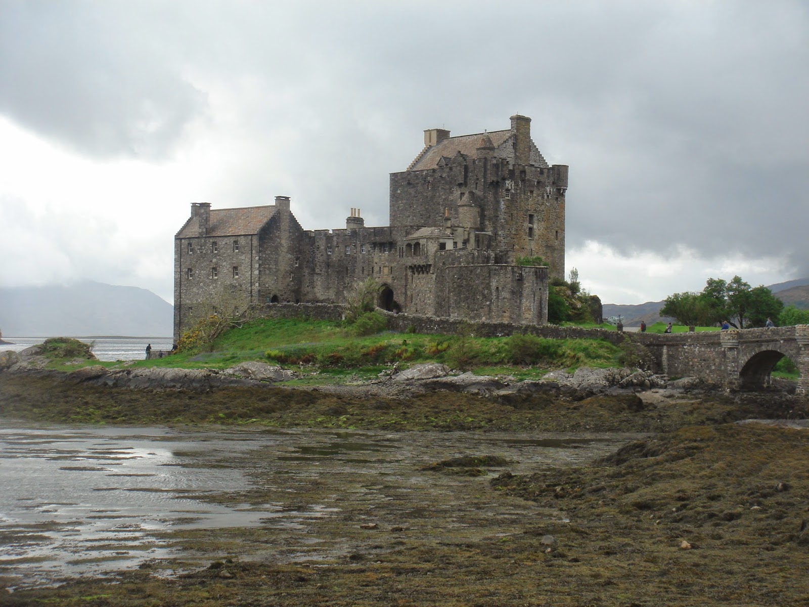
Eilean Donan
Accommodation: Sheperds Cottage, Nostie £50.00 Bnb . Nice but no TV!