Wednesday 26 October 2011

Walk 81


Llantwit Major to Porthcawl 17miles


A perfect start to the day with a lift from my friend Ken to my start point, clear blue skies and what I would describe as the perfect temperature for walking 8deg! For those of you keeping up with my blog you will see I've started to travel in the clockwse direction again so this entry links to Walk 42.


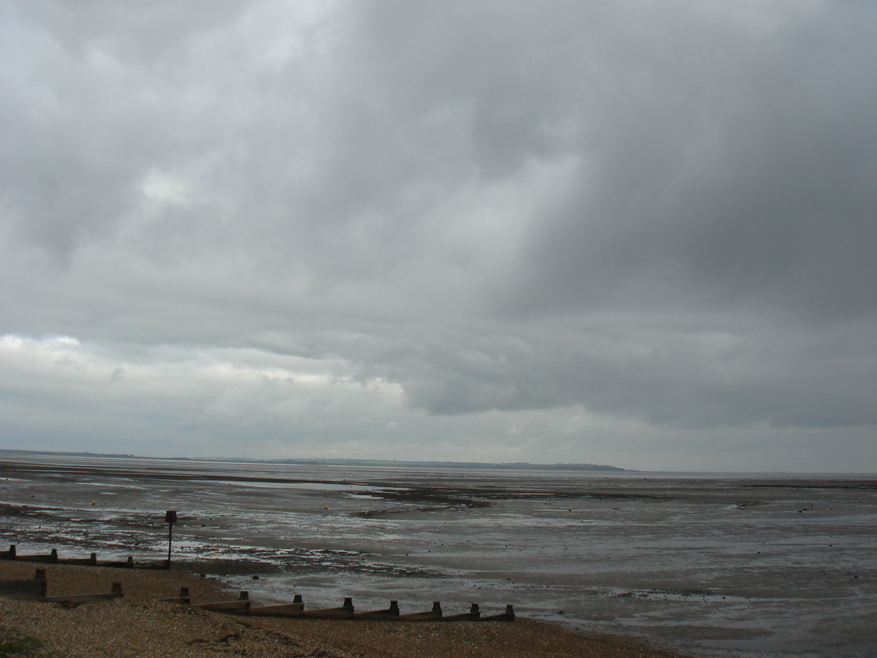
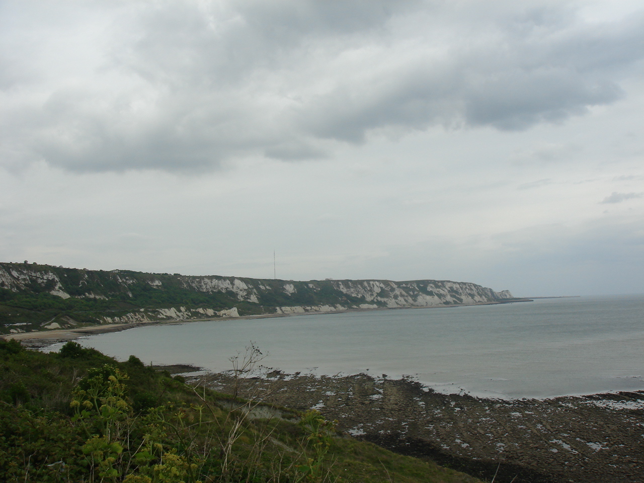
Anyhow the day itself was perfect, I started with a small climb out of Llantwit beach and it was great to see today was going to be a series of up and down valleys which were a welcome sight after the "boring fens" The first dip took me down towards St Donats College and I was impressed with their outdoor swimming pool! it was then on to the Nash Lighthouse (see pic) and a small dip to Nash point, the second pic was taken looking towards Traeth Mawr. A series of up and down valleys led me to Ogmore by the sea at this point I was faced with having to go inland due to the river estury. I walked along mostly riverbank until I reached the sewage works and then had to road walk until Ogmore castle where I could traverse the river via stepping stones which I found quite hairy!!! I was jut glad there wern't wet ! I was then into a small forest area which took me in turn to the sand dunes on Mertur-Mawr Warren, by now the wind had whipped up and blew straight in my face all the way along Porthcawl beach. Portcawl is Ok its a shame you can't get around the coast path due to a bloody big caravan site. :(

Tuesday 11 October 2011

Walk 80


Heacham to Kings Lynn 14.5miles


A nice easy walk to finish off this week of walking....I started by turning left out of Heacham and picking up the sea bank that runs more or less parallel with the disused railway line, this took me all the way to Snettisham at this point I had no choice but to turn inland and walk along the A149 for many miles via the Queens residence at Sandringham... I say I had "no Choice" but people who have gone before me have decided to take the "trespass" route from Snettisham walking along the sea bank all the way to Kings Lynn, however in my eyes this is wrong for one simple reason its ILLEGAL and us walkers get enough grief of the farming comunity as it is without adding fuel to the fire. The final 4.5miles of todays journey was following the well marked cycle path from Sandringham through the lovely villages of North Wooton and South Wooton all the w to Kings Lynn which I must say I quite liked. Pic is of a beach I took somewhere on my journey this week!!!

Walk 79


Wells Next The Sea to Heacham 22miles


Yet another poor nights sleep in the a YHA, I really dont know why I do it...............Anyhow, as I walked down the High St in Wells I was dumbfounded as why this place is so expensive to live as in my mind its just another pretty Norfolk village, but £57,000 for a beach hut....really I ask you? So the first part of todays walk was nice because in took me via a small wooded area which gave me some respite from the cold wind that had been blowwing in my face for the last 3 days! this took me into Burnham (3rd one so far). Today everything had gone back to being very flat with the only views of Norfolk Fens and of course windmills! I trudged relentlessly through Brancaster(see Pic) and onto Thornham, at this point though I do think I need to point something out....not since Essex have I had the mis-fortune to meet such miserable people during my days walking, I will ALWAYS say hello to anyone who I pass on my way but in Norfolk I was lucky to barely get a grunt out of most of the people I met SHAME ON YOU ALL.

The final part of the jouney tody was through Hunstanton and like Gt Yarmouth it was just another seaside town, however the beach was fantatstic (see pic).

Walk 78


Cromer to Wells Next The Sea 22 miles


A fair old wind kept me awake for a lot of the night (c/w lashing rain) and was there to greet me full on in the face first thing in the morning. As low tide was not until 10am I decided to walk along the beach to Sheringham, where I took the first pic of the day looking back towards Cromer. I then had no choice but to walk the rest of the day across cliffs, shingle beaches and nature reserves, along the way I went through some very pretty villages like Cley, Blakeney and Stiffkey where I managed to take a pic of an icon of Norfolk...the windmill!

Walk 77


Sea Palling to Cromer 18miles


The B&B at Sea Palling is the closest one to the beach I have ever stopped in, mind you the clue was in the name "the Beach House" A cool wind greeted me at the start of todays walk to Cromer, luckily for me the tide was out so it was beach walking all the way to Happisburgh where I took the first pic of the day of its lovely classic lighthouse. I then decided to take the cliff route to Mundesley where I stopped for a cuppa and what I can only describe as the best piece of choc cake I have tasted in a very long time...hats off to Jonet Cafe. My next decision was wether or not to try to walk the next 6 miles to Overstrand along the beach with the tide on its way in, stuff it I went for it! It wasnt until halfway I thought uh oh whats the coastguards number again! but fortunatley I made it with about 1/2 hour to spare. I took to the cliffs for the final part of the walk and skirted around the edge of the GC at Cromer which I must say is one of the nicest I have walked across for a long time. Final pic is of Cromer from my late lunchtime stop.

Walk 76


Gorleston to Sea Palling 18miles


A really nice brekie and blue sky started the day well for my walk to Sea Palling. A short walk took me into Gt Yarmouth via an inland lighthouse at Gorleston (see pic). Gt Yarmouth is like any other seaside town in the UK with its tacky shops and even tackier people! once past all the shops I hopped onto the beach (which I must say is lovely golden sand) it was then full steam ahead to California where I had to take an inland route due to the beach turning into large boulders, I only had a small 2 mile trip to Newport before I could walk the rest of the day along sand dunes and beaches. At Waxham with only a mile or so to go I decided for the first time in the 1300 miles I have covered so far to take off my walking boots and socks and have a paddle in the sea and it was just fantastic, especially when a curious seal decided to pop up his head only 5 yards out and see what I was up to!!! A perfect end to a perfect day.

Walk 75


Benacre
Southwold to Gorleston 19miles


Gorleston
I started the day with a train and bus to my start point at Southwold ( via a bacon sarnie in Halesworth!). I hopped onto the beach at Southwold and it was sand all the way to Kessingland, at Benacre reserve I took a picture of a tree growing in the sea, the tree I presume was once on the top of a piece of land but due to coastal erosion it now finds itself getting its roots wet everyday! Today was turning into another hot one with the temperature reaching a dizzy 28 deg (its the 3rd October!) I had very little road or field walking today which makes a nice change, however I did end up on the nudist beach at Corton!!! what is it with with fat people and nakedness? In between Kessingland and Corton I skirted around the edge of Lowestoft and visited the most easterly point of the mainland UK, I now have 2 of that set (southerley and easterly) only Glencoe (westerly) and Dunnet Head (northerly) to go! Just north of Lowstoft I passed into Norfolk and so another county bites the dust :) The rest of the day was spent walking along the cliffs all the way to Gorleston where the second pic was taken.

Sunday 11 September 2011

Walk 74


Thorpness
Snape to Southwold 19miles


Sizewell B
After a fantastic nights sleep I was up and ready to go at 7am. A quick trip along the river Alde estury via Black Heath Woods and I was in Aldeburgh (v.nice). I then managed to hop onto the beach and it was 'route one' for the next 6 miles, taking in Thorpeness (see pic of colourful houses) and Sizewell B neucler power station (see pic) as I aproached Dunwich after leaving the beach I noticed on the map a word I had not seen for many a mile (probably 300-400!) and that was "cliifs" I was very excited but alas what counts for a cliff in these parts would barely register as a pimple in D or C!! The remainder of the walk was through Dingle Marshes (yawn!) and then onto Southwold with its Lighthouse in the middle of town!!

Thursday 8 September 2011

Walk 73

Orford Catle

Felixstowe to Snape 22miles

A good nights sleep in the Garlston B&B and I was up and away by 9am, the day was cloudy and very autumnal. As I walked along the mile or so of promenade the annual art festival was in full swing, many artists were showing off there works in various guises and I hoped for there sake the weather would be kind to them today.

The route took me mostly along the coast for the first few miles, it was then onto the Felixstowe ferry and onwards to the Butley Ferry, in between I navigated my way past Shingle Street which is a group of cottages right on the sea front, I couldnt help wondering how long it will be before the tide swallows up those lovely houses. Just after the Butley ferry I made the decision to walk through Orford because I was told it was worth seeing, and I wasn't disapointed! The castle is fantastic so I stopped for lunch at the spot where I took the pic. The rest of the day was spent walking inland as you are still not allowed to walk all the way across the Orford Ness :( My final desination was Snape which is a very pretty village with 3 pubs!

Walk 72

Jewel o the Seas
Finton to Felixstowe 23miles

Frinton Beach
After a 7hrs car journey to our friends in Brightwell the night before I was gasping for a good walk today....and I was'nt disapointed. The weather was fantastic for the first weekend in September, 26deg and sunny!!! I had a short train journey to Frinton and my start point, luckily the tide was out so I hopped onto the beach and walked to Walton on the Naze, I then had a day of mostly inland walking all the way around to Harwich. I managed to nip onto the ferry to Felixstowe where it just timed nicely with the departing "Jewel of the Seas" ocean liner (see pic) which I must say was a spectacular sight. I met up with my friends in Felixstowe for fish and chips a great end to today's walk. It was goodbye Essex and hello Suffolk!

Sunday 17 July 2011

Walk 71

Jaywick Beach
Mersea Island to Frinton on Sea 20miles


A short 4 mile journey mostly along the beaches of Mersea took me to the ferry at East Mersea, I had pre booked it the day before and I was bang on time and the only passenger! The ferry took me to Point Clear where I hopped off to begin the main journey of the day to Frinton, this took me all the way along the sea wall and I actually got to see some proper sandy beaches today firstly at Jaywick (see Pic) then Clacton and finally Frinton!!! Frinton is just great, the mile or so of the High Street is made up of small independant shops not a Tescos in sight

Walk 70

Maldon

Steeple to Mersea island 29miles

Yes you have read it correctly I walked 29miles today in just on 9 hours, a complete cock up by me as it should have been only 25!!. So today started with a trek down the Blackwater Estury into Maldon which is very nice ( see Pic), then it was along a really quiet canal which runs along side the estury, its was a hot day today and I manged to find some shade by the side of the canal for a lunch stop (very very nice) It was then onto the main business of the day which was 13miles of road walking, which is very hard on the feet but keeps you focused in order not to get run over by some of the idiots on the road!! The final destnation of Mersea Island was very nice, and talk about saving the best till last..the B&B was fantastic the best so far in all of my travels!!! :)

Walk 69


Burnham on Crouch to Steeple 25miles


A very straight forward walk today along the seawall known locally as the "Dengie", all 25miles were on the flat and mind numbingly boring, so it was on with the Ipod set to shuffle and head down for 8 hours.  I did manage to shake off an estury today and finally met up with the North Sea (my sea of choice for the next few thousand miles!) Though the walking itself was tediousI did manage to stop off for lunch at a spot which is popular with bird watchers,  I got chatting to 5 very nice blokes who not only made me a brew but also shared their ginger nut biscuits!
                 Just after my lunch stop I managed to pop onto the beach and rounded the headland for my trek up and down the Blackwater Estury, it was at this point I had my first view of the now decomissioned nuclear power station at Bradwell, what a complete eysore, big ugly brute of a building walked very quickly past it!  The rest of the day was plain sailing all the way into Steeple and my nights accomodation ( which for £50 was pretty poor).

Walk 68


Southend to Burnham on Crouch 22miles


Well Southend what can I say......I started walking in the morning quickly! and the first stop was Shoeburyness which was a breath of fresh air compared with last night, you can always tell by the size of the houses in a town!!! The rest of the day was very forgettable spent walking across fields and country lanes in a vain atempt at navigating yet another estury, the only pic of the day is of the approach to Burnham taken aboard the ferry.

Walk 67


Benfleet to Southend 7miles


A 41/2hr train journey took me to my start point at Benfleet, I decided to take the "senic" route to Southend via Leigh on Sea. I skirted around the bay with Canvey Island on my right and eventually Hadleigh Castle on my left(see Pic) reaching Leigh in under an hour, I like Leigh with its fancy resturants and cobbled streets :) it was then onto Southend and my nights rest in the WORST B&B I have ever had the misfortune to stop in, the room had a bed and a table lamp!

Monday 20 June 2011

Walk 66


Gravesend to Benfleet 20miles


A short walk took me thru Gravesend town which was very nice and then onto the ferry across the Thames to a new county..... Essex, it was with sadness I sai farewell to Kent beause I have really enjoyed the experience and in the process managed to chalk off another long distance walk...The Saxon Shore Way which Iam now the pround owner of a certificate to prove I did it!!!! thank you Kent county council :) The walk today took me along the "other" side of the Thames Estury past another fort(see pic) and on thru the Essex countryside, and because of the amount of river esturies things start to get difficult in terms of actually seeing the coast for what seems like most of the county of Essex.

Walk 65


Gillingham to Gravesend 22miles


A day of inland walking up and down the River Medway and River Thames. Once out of Gillingham it was onto Rochester and across the bridge which is where I took the first pic of the day looking back to the Castle. This week of walking has sent me past so many castles in Kent I've lost count! one way of keeping the French out!!!!!LOL As I navigated the Medway I came across a rotting submarie in the shallows(see pic2) of the bay at Upper Upnor. It was then onto Hoo St Werburgh where I had to head inland in order to link up with the mighty Thames, along the way yet another castle caught my eye (see pic 3) at a place called Cooling (great name!) The rest of the journey to Gravesend was along the Thames Estury.

Walk 64


Sittingbourne to Gillingham 18miles


3 trains and a cooked breakfast later and I had reached my start point at Sittingbourne. Most of today was to be spent walking along the esturies of the River Swale and River Medway. The first pic is of the bridge acorss the river to the Isle of Sheppy and the 2nd pic is of a boat "graveyard" where for some reason all these vessels had been left to rot...truly bizzare. The walk today then took me inland along country lanes and thru a lot of small villages... I decieded to stop for lunch in the village of Lower Halstow at the 3 tuns pub, in doing so I met a nice couple who were more than willing to tell me as much local knowledge as my brain could take in about the surrounding area!, I have found that the nice people of Kent more than willing in this aspect and long may it continue

Walk 63


Whitstable to Sittingbourne 17miles


A dull day greeted me today as I boarded my train to the start point at Whitstable. Again another very flat stage of walking, firstly on thru Seasalter where I took the only pic of the day which is of the Isle of Sheppy, it was then inland all the way to Sittingbourne via Faversham which has a very famous brewery and boy could you smell it ....I nearly fell over!!!! then it was on thru Teyham to my final destination. Even though today was mostly inland due to the problems of river esturies I still found it very interesting as I got to walk across some of Kents finest countryside with its fields of barley, wheat and of course Hops. Tonights enertainment was Roger Waters The Wall concert at the O2...what a show and well worth the 30year wait!!

Walk 62

Broadstairs
Reculver Castle


Ramsgate to Whitstable 24miles


Another nice early start today but with no pack....what a relief as my shoulders are really starting to ache. Today's walk was due to be mainly flat and I wasn't disappointed!. A lot of the Kent coast seemed to have a lot more to offer (unlike Sussex!).......in fact I had a lot of pre conceptions about this part of the coast (kiss me quick hats, gaudy etc etc) but how wrong could I be!!!
So the first port of call today was Broadstairs, then a long succession of small beautiful bays all the along the coast to Margate, unfortunately Margate let the side down.....they have tried to spruce it up by putting the Turner Gallery on the seafront but as I always say" you cant polish a turd!" The rest of the day was spent hugging the coast past the roman fort at Relculver onto and through Herne Bay and finally onto Whitstable.

Wednesday 25 May 2011

Walk 61

Channel Tunnel leaving England!
Sandwich GC

White Cliffs of Dover!
Deal Castle


Capel to Ramsgate 26miles


A long day beckoned so I had a 8.15am start wth a bus to my start point at Capel, it was then onto Dover and on the way I took a pic of where the channel tunnel leaves England.  The walking was very up and down all the way to St Margarets Bay, the views were fantastic with all the white chalk cliffs. Today was also a day of three castles at Dover, Deal and Walmer and lots of golf courses climaxing with the Wembley of all GC's at Sandwich which is the venue of this years British Open. They were well on the way to getting the GC at Sandwich ready for the Open with the erecting of the stands near the start/finish of the course, I was lucky as the path I was on cut right across the whole course :). As I walked thru Sandwich I was a bit dissapointed as the town itself is nice but they have built a big ugly industrial estate less than 1/2 a mile out of town...a real blight. The rest of the walk was along the river Stour which led onto Ramsgate, I arrived at the B&B at 5pm which is nearly 9hrs walking, I was very achey and tired but very satisfied with my days achivement. The Abbeygail B&B is very nice, in fact I quite like Ramsgate :)

Walk 60


White Cliffs


Lydd to Capel(nr Folkestone) 25miles

Battle of Britain Memorial
I have now crossed into another county, Kent the garden of England or at the mo is should read the Desert of England!....after so little rain for the last 3 months some of the fields I have crossed have cracks in them 3ins wide I could get my hand in and feel the earths crust !!!LOL


So after a very average nights sleep at the George Hotel in Lydd I was greeted with breakie, where bizzarely I had to pay per Item ie. Bacon rasher 90p, Egg 50p, Tomato 50p etc etc. First part of the walk today was along the Romney Marshes and then onto Romney Beach itself, its was all flat walking thru Dymchurch, Hythe and then onto Folkestone. I managed to drop my pack at the hotel in Folkestone so I could walk the last 4 miles and boy was I glad, because just outside Folkestone is a monster hill that leads onto the white cliffs path  The final photo of the day was taken of the Battle of Brittain memorial nr Capel over looking the English Channel....enough said......

Tuesday 24 May 2011

Walk 59


Hastings to Lydd 18miles


With a clear blue sky and the smell of sun tan lotion in my nostrils I knew this week was going to be a good un!. A nice steep climb out of Hastings started the walk with a fabulous view over the bay(see pic), the next 5 miles to Fairlight continued with up and down valleys and I could have be mistaken that I was back in Devon or Cornwall! After Fairlight came Winchelsea Beach(see Pic) and then onto Rye and Camber Sands. The third pic is of Camber Castle which bizzarely is in the middle of a farmers field( or should that be the other way round!) no access to the castle other than on foot....after talking with a "local" it turns out the castle was actually by the sea until 1278 but due to the opposite of global warming(?) it is now 6 miles inland. The final part of todays walk was past Dungeness Nuclear Pwr Station and on to Lydd.

Tuesday 5 April 2011

Wak 58


Eastbourne to Hastings 17miles


A good nights sleep in a nice hotel is always a great way to finish off a week of walking, 151 miles this week mostly on the flat but my feet and legs could do with a rest! I walked out of Eastburne on a dull and overcast day, a quick trip through the marina and I was in open country. Again not much to say other than flat....and pretty forgettable, I managed to cover the 17miles in 5.5hrs just in time to watch the footie in the pub!!! Pic is of Hastings from a far.....

Monday 21 March 2011

Walk 57


Brighton to Eastbourne 24miles


Another warm sunny day greeted me on what was going to be the hardest day walking of my week away. It was nice and easy all the thru Peacehven, Newhaven and onto Seaford, it was at Seaford I saw a sight for sore eyes.....a HILL...a nice big un as well!!!!, once at the top the view to Seaford was fantastic(see Pic1), and yes that is a golf course at the top of the hill!!!. I travelled another mile or so to be greeted with a view to end all views(see pic 2)...the Seven Sisters, I had to stand there staring for several minutes just to take in the view :). The next task was to tackle these hills which wasn't too bad, up and down 7 times, easy peasy when you compare with some of the valleys I have had to walk in D&C!. The final part of the walk took in Beachy Head (see pic3) with its familier red and white lighthouse stuck out on a rock looking very precarious.

Friday 18 March 2011

Walk 56


Littlehampton to Brighton 21miles


A stong westerly was blowing today which worked in my favour on my way along the beach to Brighton, nothing much else to say about today other than ....Flat. Brighton itself was buzzing and very lively you can understnd why people live here. Pic is of Brighton pier.

Walk 55

Selsey to Littlehampton 20miles

A nice day greeted me today as I set off firstly to Pagham and then onto Littlehampton. The walk today was as dull as dishwater! I really can't say any thing positive about todays walk........Oh yea I walked thru Bognor, what a dump....... the whole day was flat and boring. A change of county today goodbye Hampshire hello West Sussex

Walk 54


Southsea to Selsey 20miles


Another glorious crisp sunny morning greeted me today, a short 2 mile walk to the Hayling Island ferry and I had it all to myself! the water was so flat calm it was like a scene from a horror film....spooky! :) Once off the ferry I had a really nice walk along the disused Hayling to Havant railway line which is now a nature reserve (see Pic) The next part of the walk was to Emsworth and then onto West Wittering, the rest of the walk toSelsey was along a shingle beach....ouch my feet hurt!!!

Walk 53


Southampton to Southsea 25miles


A short 2 mile walk took me to the Hythe ferry(1st of 3 today!) across Southampton water (see pic), the pier at Hythe has its own railway from the ticket booth to where the ferry leaves and apparently this was built in 1878 and is the oldest pier train still running in the world. A nice ferry ride across the bay was then followed by a not so nice walk thru Southampton (too much traffic), once out of the city I walked along the bay to Hamble which was very nice. The second ferry of the day was from Hamble to Warsash, this is where I nearly ended up on e "wrong" boat......I was ambling towards the ferry jetty when I saw a boat just about to cast off so I made a dash for it but just missed it.......t was a good job I missed it as it was not my ferry but a pleasure craft!!! I had visions aftwards of me leaping from the jetty onto the boat only to end up in the IOW!!!
The walk to the next ferry at Gosport was univentful and very flat, until I got to the army ranges at Browndown which were open so you could walk across, the only problem was that it was 2miles of shingle beach! I nearly got caught in the rush hour crush at the Gosport ferry as I ended up walking down the exit lane of the walk towards the ferry just as wall of commuters deposited of the incoming ferry! a quick leap over the chains dividing the lanes soon sorted me out before I was swamped!!!! Another trip thru a big town(Portsmouth) greeted me after the Gosport ferry....enough said. The second pic is of the Big sail at the mouth of the port at Portsmouth. A complete milage cock up again today as I thought I was only going to do 21 miles and ended up doing 25!!!! no wonder I was on my knees when I reached Southsea :(

Walk 52


Milford on sea to Southampton 21miles


A very cold raw north westerly wind greeted me today at the start of this walk and stayed with me for the duration! The first stop of the day ws Lymington (see Pic) very quaint with its cobbled streets and little shops. A short walk took me thru to Bealieu which was nice, it was then onto my final destination Southampton c/w huge oil refinery!!! Todays walk can be described as FLAT! and I had to do a fair bit of road work....sign of things to come....The B&B was great with free WIFI :)

Walk 51


Christchurch to Milford on Sea 9miles


I had to drive to Christchurch today and drop the car off for the week....I hope its there when I get back!!!! As I walked towards Milford I had to climb a hill to take the picture on this entry of my blog, this would be the last hill to climb for over 100 miles!. The view from the top of the hill was fantastic stretching all the way to Harrys Rocks. A ferry to Mudeford greeted me at the bottom of the hill and then it was a straight forward 6 mile walk along the beach into Milford on Sea, I crossed the county border into Hampshire today so farwell Dorset. As I arrived into Milford the IOW came into view and I had a great view of the Needles. I stopped in a nice B&B in Milford and in the evening decided to go out for a meal so I chose the closest to the B&B which just happened to be the Zaika Indian Resturant but to my horror they refused to serve me because and I quote " we do not have any tables for one".....so if your ever in Milford, you now know where not to go!